Connagill Cluster Wind Farm Connections
- Type:
- Windfarm connection
- Location:
- Highland
Upgrading infrastructure for Connagill Cluster, delivering energy reliability and supporting the transition to net zero.
Overview
About the Project
The Connagill Cluster comprises the recently consented Strathy Wood (65 megawatt (MW)) and Strathy South (208MW) Wind Farms, as well as the proposed Armadale (58MW), Melvich (58MW) and Kirkton (53MW) Wind Farms.
Optioneering studies have been ongoing since 2021 to connect the consented Strathy South, Strathy Wood, and proposed Armadale Wind Farms to the transmission network. The initial optimal technology solution for each connection was via overhead line supported by trident ‘H’ wood pole, which was presented to statutory consultees in 2022 during an informal project update.
Since then, two further connections have been agreed for the proposed Melvich and Kirkton Wind Farms, and it is no longer the optimal solution from a technical, operational, or environmental perspective to have numerous separate wood pole overhead lines running in parallel for long distances for each connection. Extensive further review has, therefore, been carried out to identify a rationalised approach to facilitate all the connections.
Why is the Project Required?
Under our Network Operators Licence we are required to provide connections for five proposed wind farms in the Strathy area, collectively known as the Connagill Cluster.
These connections should be delivered in a technically efficient, co-ordinated, and economic manner, whilst having the least practicable impact on people and the environment. All connections are to be provided at 132kV and are proposed to be accommodated on wood pole and steel lattice overhead lines.
Find out more about the Strathy Wood Wind Farm Connection
Find out more about the Strathy North to Connagill 275kV overhead line

Community Engagement
Throughout the life of our projects, we aim to work positively with local communities and keep people informed about what we are doing. This is particularly important when we are developing a proposal and we want to understand what local people think about our plans.
We endeavour to take the time to discuss proposals with local community councils, encourage engagement from the wider community and listen to the feedback we receive.
We will do our best to answer any questions and address issues or concerns that are raised with us.
When our project progresses into construction, we will continue working closely with the local community to ensure that our work has as little impact on the lives of those living and working in the area and as many long term positive effects as possible.

How we’re embracing artificial intelligence (AI)
We intend to use AI to assist our experienced teams in the analysis of your feedback, so we can categorise key points raised more quickly. You can learn more about how we’re utilising AI on this dedicated web page.
Project Updates
Project updates
-
We're here to lend a helping hand
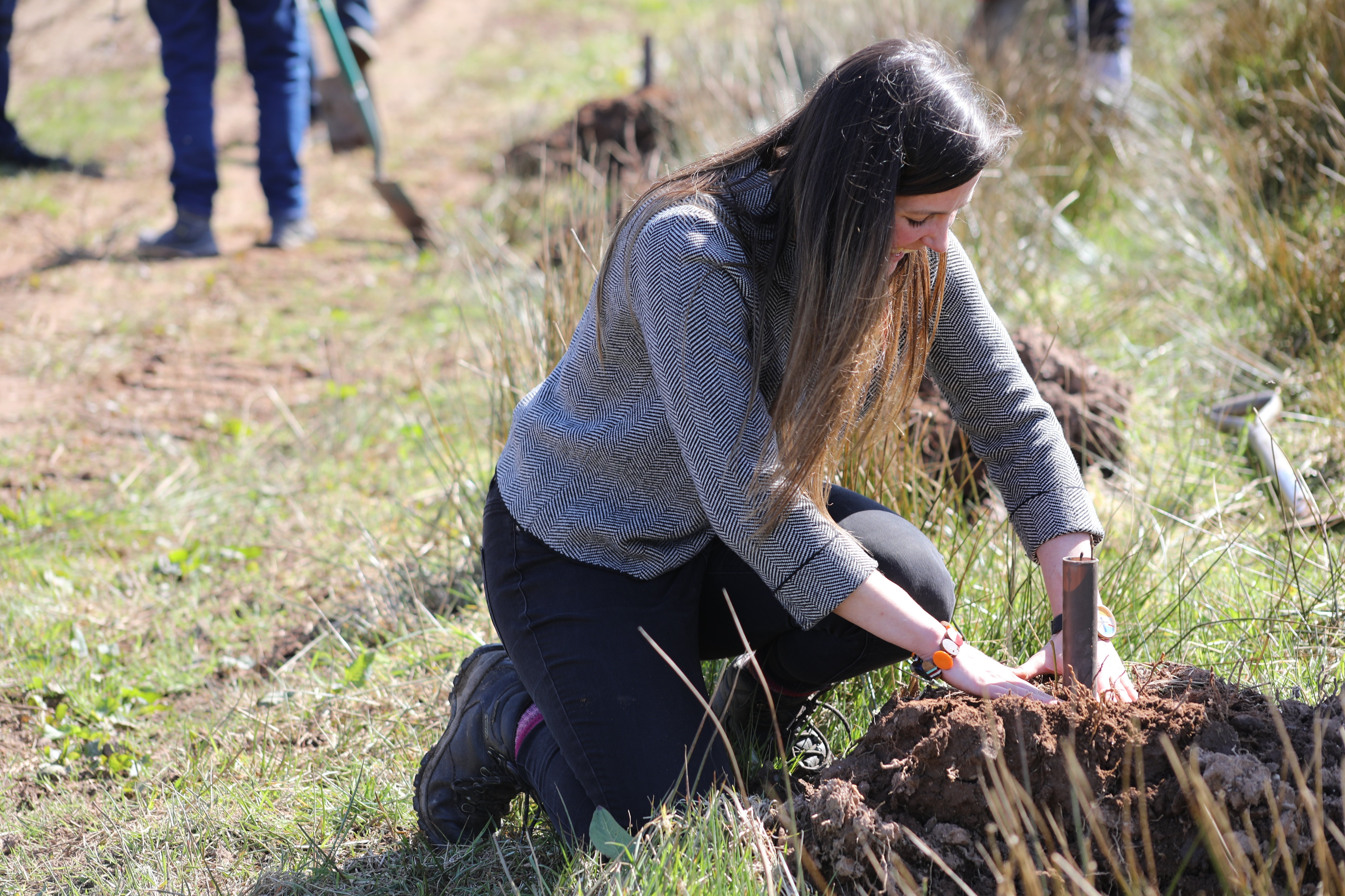
We are committed to supporting the communities in the north of Scotland where we operate, both now and in the future. As part of our ongoing efforts to make a difference and have a positive impact on local communities, we are proud to offer volunteering days to local groups and charities, particularly in the areas that host our electricity infrastructure or where our proposed projects are located.
This month, we’re excited to announce the launch of our new Volunteering Webpage, designed to make it easier for local communities to request volunteering support from us. To request our help, simply complete the ‘Volunteering Nomination Form’ linked at the bottom of our new webpage. Please note, as our team works on a voluntary basis, it may take us some time to coordinate our people and match them with opportunities. We kindly ask for your patience as we work to keep up with volunteering demand.
Thank you for considering SSEN Transmission as a partner in your community efforts. Together, we can leave a positive, lasting legacy and help transform communities across the north of Scotland.
Documents
Planning Application - Additional Information
-
Strathy Wood Grid Connection EIA Additional Information - Addendum to HRA and WHS.pdf
- Type:
- Date:
- 30 June 2025
- Size:
- 8.3 MB
-
Strathy Wood Grid Connection EIA Additional Information - Cumulative Addendum.pdf
- Type:
- Date:
- 30 June 2025
- Size:
- 535.3 KB
-
Strathy Wood Grid Connection EIA Additional Information - Peat Condition Assessment.pdf
- Type:
- Date:
- 30 June 2025
- Size:
- 9.2 MB
Planning Application - Planning Statement
-
Strathy N to Connagill Planning Statement Final Issue 17.02.25.pdf
- Type:
- Date:
- 05 March 2025
- Size:
- 1.2 MB
-
Strathy N to Connagill Planning Statement Final Issue 11.02.25.pdf
- Type:
- Date:
- 05 March 2025
- Size:
- 1.1 MB
Planning Application - Non Technical Summary
-
Strathy South Wind Farm Grid Connection - Non-Technical Summary.pdf
- Type:
- Date:
- 05 March 2025
- Size:
- 7.2 MB
Planning Application - Socio-economic and Tourism TN
-
Strathy South Wind Farm Grid Connection - Socio-economic and Tourism Technical Note .pdf
- Type:
- Date:
- 05 March 2025
- Size:
- 4.5 MB
Planning Application - EIA Report Volume 1: Main Report
-
Volume 1 Chapter 1 Introduction and Background.pdf
- Type:
- Date:
- 05 March 2025
- Size:
- 354.3 KB
-
Volume 1 Chapter 10 Cultural Heritage.pdf
- Type:
- Date:
- 05 March 2025
- Size:
- 346.9 KB
-
Volume 1 Chapter 11 Traffic and Transport.pdf
- Type:
- Date:
- 05 March 2025
- Size:
- 383.9 KB
-
Volume 1 Chapter 12 Forestry.pdf
- Type:
- Date:
- 05 March 2025
- Size:
- 321.3 KB
-
Volume 1 Chapter 13 Schedule of Mitigation.pdf
- Type:
- Date:
- 05 March 2025
- Size:
- 394.1 KB
-
Volume 1 Chapter 2 The Routeing Process and Alternatives.pdf
- Type:
- Date:
- 05 March 2025
- Size:
- 1.1 MB
-
Volume 1 Chapter 3 The Proposed Development.pdf
- Type:
- Date:
- 05 March 2025
- Size:
- 952.2 KB
-
Volume 1 Chapter 4 Scope and Consultation.pdf
- Type:
- Date:
- 05 March 2025
- Size:
- 407 KB
-
Volume 1 Chapter 5 EIA Process and Methodology.pdf
- Type:
- Date:
- 05 March 2025
- Size:
- 262 KB
-
Volume 1 Chapter 6 Landscape and Visual.pdf
- Type:
- Date:
- 05 March 2025
- Size:
- 1.5 MB
-
Volume 1 Chapter 7 Ecology.pdf
- Type:
- Date:
- 05 March 2025
- Size:
- 710.6 KB
-
Volume 1 Chapter 8 Ornithology.pdf
- Type:
- Date:
- 05 March 2025
- Size:
- 1.1 MB
-
Volume 1 Chapter 9 Soils Geology and Water.pdf
- Type:
- Date:
- 05 March 2025
- Size:
- 610.3 KB
-
Volume 1 Front Cover Contents and Glossary.pdf
- Type:
- Date:
- 05 March 2025
- Size:
- 4.3 MB
Planning Application - EIA Report Volume 2: Figures
-
Volume 2 Figure V1-1.1 Overview of the Proposed Development.pdf
- Type:
- Date:
- 05 March 2025
- Size:
- 3.7 MB
-
Volume 2 Figure V1-10.1 Cultural Heritage.pdf
- Type:
- Date:
- 05 March 2025
- Size:
- 8.9 MB
-
Volume 2 Figure V1-12.1 Forestry Study Area.pdf
- Type:
- Date:
- 05 March 2025
- Size:
- 4.7 MB
-
Volume 2 Figure V1-12.2 Aerial Imagery of Baseline Forestry.pdf
- Type:
- Date:
- 05 March 2025
- Size:
- 2.6 MB
-
Volume 2 Figure V1-12.3 Forestry Felling.pdf
- Type:
- Date:
- 05 March 2025
- Size:
- 3.2 MB
-
Volume 2 Figure V1-2.1 Proposed Route.pdf
- Type:
- Date:
- 05 March 2025
- Size:
- 4.2 MB
-
Volume 2 Figure V1-2.2 Proposed Alignment.pdf
- Type:
- Date:
- 05 March 2025
- Size:
- 4.2 MB
-
Volume 2 Figure V1-3.1 The Proposed Development Proposed Alignment.pdf
- Type:
- Date:
- 05 March 2025
- Size:
- 8.5 MB
-
Volume 2 Figure V1-3.2 Proposed Dismantling Works Proposed Alignment.pdf
- Type:
- Date:
- 05 March 2025
- Size:
- 7.4 MB
-
Volume 2 Figure V1-6.1 Zone of Theoretical Visibility.pdf
- Type:
- Date:
- 05 March 2025
- Size:
- 9.2 MB
-
Volume 2 Figure V1-6.2 Landscape Designations and Protected Areas.pdf
- Type:
- Date:
- 05 March 2025
- Size:
- 4.8 MB
-
Volume 2 Figure V1-6.3 Landscape Character Types.pdf
- Type:
- Date:
- 05 March 2025
- Size:
- 5 MB
-
Volume 2 Figure V1-6.4a Building Based Visual Receptors.pdf
- Type:
- Date:
- 05 March 2025
- Size:
- 2.9 MB
-
Volume 2 Figure V1-6.4b Building Based Visual Receptors.pdf
- Type:
- Date:
- 05 March 2025
- Size:
- 3.5 MB
-
Volume 2 Figure V1-6.4c Building Based Visual Receptors.pdf
- Type:
- Date:
- 05 March 2025
- Size:
- 3.4 MB
-
Volume 2 Figure V1-6.4d Building Based Visual Receptors.pdf
- Type:
- Date:
- 05 March 2025
- Size:
- 3.2 MB
-
Volume 2 Figure V1-6.4e Building Based Visual Receptors.pdf
- Type:
- Date:
- 05 March 2025
- Size:
- 2.9 MB
-
Volume 2 Figure V1-6.4f Building Based Visual Receptors.pdf
- Type:
- Date:
- 05 March 2025
- Size:
- 3.5 MB
-
Volume 2 Figure V1-6.5 Routes and Outdoor Based Visual Receptors.pdf
- Type:
- Date:
- 05 March 2025
- Size:
- 4.2 MB
-
Volume 2 Figure V1-6.6 Developments included in the Cumulative Assessment.pdf
- Type:
- Date:
- 05 March 2025
- Size:
- 4.1 MB
-
Volume 2 Figure V1-7.1 Desk Study Area and Cumulative Effects Study Area.PDF
- Type:
- Date:
- 05 March 2025
- Size:
- 1.8 MB
-
Volume 2 Figure V1-7.2 Statutory and Non-Statutory Designated Sites.pdf
- Type:
- Date:
- 05 March 2025
- Size:
- 2.9 MB
-
Volume 2 Figure V1-7.3 Protected Species Survey Area.pdf
- Type:
- Date:
- 05 March 2025
- Size:
- 4.1 MB
-
Volume 2 Figure V1-7.4 Habitat Survey Areas.PDF
- Type:
- Date:
- 05 March 2025
- Size:
- 4.1 MB
-
Volume 2 Figure V1-7.5 Static Bat Recorder Survey Locations.PDF
- Type:
- Date:
- 05 March 2025
- Size:
- 4.6 MB
-
Volume 2 Figure V1-7.7 Habitat Survey Results.pdf
- Type:
- Date:
- 05 March 2025
- Size:
- 8.4 MB
-
Volume 2 Figure V1-8.1a Desk Study Areas Statutory Designated Sites.pdf
- Type:
- Date:
- 05 March 2025
- Size:
- 2.9 MB
-
Volume 2 Figure V1-8.1b Desk Study Areas Data Requests.pdf
- Type:
- Date:
- 05 March 2025
- Size:
- 3 MB
-
Volume 2 Figure V1-8.1c Desk Study Areas Data from Surrounding Developments.pdf
- Type:
- Date:
- 05 March 2025
- Size:
- 3.3 MB
-
Volume 2 Figure V1-8.2 Proposed Alignment 2022 VP Locations, Viewsheds and SBBS Area.pdf
- Type:
- Date:
- 05 March 2025
- Size:
- 5.9 MB
-
Volume 2 Figure V1-8.3 Alternative Alignment 2023 VP Locations, Viewsheds and Survey Areas.pdf
- Type:
- Date:
- 05 March 2025
- Size:
- 6.1 MB
-
Volume 2 Figure V1-8.4 Statutory Sites of Ornithological Importance within the Study Areas.pdf
- Type:
- Date:
- 05 March 2025
- Size:
- 3.6 MB
-
Volume 2 Figure V1-8.5a Desk Study Records of Breeding Wader Territories within Study Area 2016.pdf
- Type:
- Date:
- 05 March 2025
- Size:
- 6 MB
-
Volume 2 Figure V1-8.5b Desk Study Records of Wildfowl and Wader Flights within Study Area 2016.pdf
- Type:
- Date:
- 05 March 2025
- Size:
- 5.5 MB
-
Volume 2 Figure V1-8.5c Desk Study Records of Wildfowl and Raptor Flights within Study Area 2017.pdf
- Type:
- Date:
- 05 March 2025
- Size:
- 5.5 MB
-
Volume 2 Figure V1-8.5d Desk Study Records of Wildfowl and Raptor Flights within Study Area 2018.pdf
- Type:
- Date:
- 05 March 2025
- Size:
- 5.1 MB
-
Volume 2 Figure V1-8.5e Desk Study Records of Wildfowl and Raptor Flights within Study Area 2019.pdf
- Type:
- Date:
- 05 March 2025
- Size:
- 1.7 MB
-
Volume 2 Figure V1-8.5f Desk Study Records of Wildfowl, Wader and Raptor Flights within Study Area 2020.pdf
- Type:
- Date:
- 05 March 2025
- Size:
- 2 MB
-
Volume 2 Figure V1-8.5g Desk Study Records of Wildfowl, Wader and Raptor Flights within Study Area 2021.pdf
- Type:
- Date:
- 05 March 2025
- Size:
- 2.8 MB
-
Volume 2 Figure V1-8.5h Desk Study Records of Wildfowl, Wader and Raptor Flights within Study Area 2022.pdf
- Type:
- Date:
- 05 March 2025
- Size:
- 2.1 MB
-
Volume 2 Figure V1-8.6a Proposed Alignment 2022 Target Species Flights.pdf
- Type:
- Date:
- 05 March 2025
- Size:
- 2.3 MB
-
Volume 2 Figure V1-8.6b Proposed Alignment 2022 Wildfowl and Wader Breeding Territories.pdf
- Type:
- Date:
- 05 March 2025
- Size:
- 5.8 MB
-
Volume 2 Figure V1-8.7a Alternative Alignment 2023 Target Species Flights excluding Hen Harrier.pdf
- Type:
- Date:
- 05 March 2025
- Size:
- 6.2 MB
-
Volume 2 Figure V1-8.7b Alternative Alignment 2023 Wildfowl and Wader Breeding Territories.pdf
- Type:
- Date:
- 05 March 2025
- Size:
- 5.9 MB
-
Volume 2 Figure V1-9.1.1 to 9.1.7 Local Hydrology.pdf
- Type:
- Date:
- 05 March 2025
- Size:
- 4.2 MB
-
Volume 2 Figure V1-9.2 Soils.pdf
- Type:
- Date:
- 05 March 2025
- Size:
- 3.7 MB
-
Volume 2 Figure V1-9.3.1 to 9.3.7 Superficial Geology.pdf
- Type:
- Date:
- 05 March 2025
- Size:
- 3.6 MB
-
Volume 2 Figure V1-9.4 Peatland Classification.pdf
- Type:
- Date:
- 05 March 2025
- Size:
- 3.8 MB
-
Volume 2 Figure V1-9.5.1 to 9.5.7 Bedrock Geology.pdf
- Type:
- Date:
- 05 March 2025
- Size:
- 3.2 MB
-
Volume 2 Figure V1-9.6 Regional Hydrogeology.pdf
- Type:
- Date:
- 05 March 2025
- Size:
- 3.6 MB
-
Volume 2 Figure V1-9.7 Aquifer Classifications and Groundwater Vulnerability.pdf
- Type:
- Date:
- 05 March 2025
- Size:
- 4 MB
-
Volume 2 Figure V1-9.8.1 to 9.8.7 - Ground Water Dependent Terrestrial Ecosystem.pdf
- Type:
- Date:
- 05 March 2025
- Size:
- 3.6 MB
-
Volume 2 Figure V5-2.1 Alternative Route Options.pdf
- Type:
- Date:
- 05 March 2025
- Size:
- 3 MB
-
Volume 2 Figure V5-2.2 Proposed Alternative Route and Alternative Alignment Options.pdf
- Type:
- Date:
- 05 March 2025
- Size:
- 4.3 MB
-
Volume 2 Figure V5-3.1 The Proposed Development Alternative Alignment.pdf
- Type:
- Date:
- 05 March 2025
- Size:
- 9 MB
-
Volume 2 Figure V5-3.2 Proposed Dismantling Works and Temporary Diversions Alternative Alignment.pdf
- Type:
- Date:
- 05 March 2025
- Size:
- 7.4 MB
-
Volume 2 Figure V5-4.1 Zone of Theoretical Visibility Alternative Alignment Alternative Alignment.pdf
- Type:
- Date:
- 05 March 2025
- Size:
- 6.6 MB
-
Volume 2 Figure V5-4.2 Designated and Protected Landscapes Alternative Alignment.pdf
- Type:
- Date:
- 05 March 2025
- Size:
- 4.7 MB
-
Volume 2 Figure V5-4.3 Landscape Character Types Alternative Alignment.pdf
- Type:
- Date:
- 05 March 2025
- Size:
- 5 MB
-
Volume 2 Figure V5-4.4a Building Based Visual Receptors Alternative Alignment.pdf
- Type:
- Date:
- 05 March 2025
- Size:
- 3 MB
-
Volume 2 Figure V5-4.4b Building Based Visual Receptors Alternative Alignment.pdf
- Type:
- Date:
- 05 March 2025
- Size:
- 3.6 MB
-
Volume 2 Figure V5-4.4c Building Based Visual Receptors Alternative Alignment.pdf
- Type:
- Date:
- 05 March 2025
- Size:
- 3.5 MB
-
Volume 2 Figure V5-4.4d Building Based Visual Receptors Alternative Alignment.pdf
- Type:
- Date:
- 05 March 2025
- Size:
- 3.2 MB
-
Volume 2 Figure V5-4.4e Building Based Visual Receptors Alternative Alignment.pdf
- Type:
- Date:
- 05 March 2025
- Size:
- 2.9 MB
-
Volume 2 Figure V5-4.4f Building Based Visual Receptors Alternative Alignment.pdf
- Type:
- Date:
- 05 March 2025
- Size:
- 3.6 MB
-
Volume 2 Figure V5-4.5 Route and Outdoor Based Visual Receptors Alternative Alignment.pdf
- Type:
- Date:
- 05 March 2025
- Size:
- 4.2 MB
-
Volume 2 Figure V5-4.6 Developments included in the Cumulative Assessment Alternative Alignment.pdf
- Type:
- Date:
- 05 March 2025
- Size:
- 4.1 MB
-
Volume 2 Figure V5-5.1Desk Study Area and Cumulative Effects Study Area Alternative Alignment.PDF
- Type:
- Date:
- 05 March 2025
- Size:
- 1.7 MB
-
Volume 2 Figure V5-5.2 Statutory and Non Statutory Designated Sites Alternative Alignment.pdf
- Type:
- Date:
- 05 March 2025
- Size:
- 2.4 MB
-
Volume 2 Figure V5-5.3 Protected Species Survey Area Alternative Alignment.pdf
- Type:
- Date:
- 05 March 2025
- Size:
- 4 MB
-
Volume 2 Figure V5-5.4 Habitats Survey Area Alternative Alignment.PDF
- Type:
- Date:
- 05 March 2025
- Size:
- 4 MB
-
Volume 2 Figure V5-5.5 Static Bat Recorder Survey Locations Alternative Alignment.PDF
- Type:
- Date:
- 05 March 2025
- Size:
- 4.5 MB
-
Volume 2 Figure V5-5.7 Habitats Survey Results Alternative Alignment.pdf
- Type:
- Date:
- 05 March 2025
- Size:
- 8.1 MB
-
Volume 2 Figure V5-6.1a DeskStudy Areas Alternative Alignment.pdf
- Type:
- Date:
- 05 March 2025
- Size:
- 2.7 MB
-
Volume 2 Figure V5-6.1b DeskStudy Areas Data Requests Alternative Alignment.pdf
- Type:
- Date:
- 05 March 2025
- Size:
- 2.9 MB
-
Volume 2 Figure V5-6.1c DeskStudy Areas Surrounding Developments Alternative Alignment.pdf
- Type:
- Date:
- 05 March 2025
- Size:
- 3.1 MB
-
Volume 2 Figure V5-6.2 Proposed Alignment 2022 VP Locations Viewsheds and SBBS Area Alternative Alignment.pdf
- Type:
- Date:
- 05 March 2025
- Size:
- 5.8 MB
-
Volume 2 Figure V5-6.3 Alternative Alignment 2023 VP Locations Viewsheds and Survey Areas Alternative Alignment.pdf
- Type:
- Date:
- 05 March 2025
- Size:
- 6 MB
-
Volume 2 Figure V5-6.4 Statutory Sites of Ornithological Importance within the Study Areas Alternative Alignment.pdf
- Type:
- Date:
- 05 March 2025
- Size:
- 3.2 MB
-
Volume 2 Figure V5-6.5a Wader Territories 2016 Alternative Alignment.pdf
- Type:
- Date:
- 05 March 2025
- Size:
- 5.8 MB
-
Volume 2 Figure V5-6.5b Wildfowl Wader Flights 2016 Alternative Alignment.pdf
- Type:
- Date:
- 05 March 2025
- Size:
- 5.4 MB
-
Volume 2 Figure V5-6.5b Wildfowl Wader Raptor Flights 2016.pdf
- Type:
- Date:
- 05 March 2025
- Size:
- 1 MB
-
Volume 2 Figure V5-6.5c Wildfowl Raptor Flights 2017 Alternative Alignment.pdf
- Type:
- Date:
- 05 March 2025
- Size:
- 5.4 MB
-
Volume 2 Figure V5-6.5d Wildfowl Raptor Flights 2018 Alternative Alignment.pdf
- Type:
- Date:
- 05 March 2025
- Size:
- 5 MB
-
Volume 2 Figure V5-6.5e Wildfowl Raptor Flights 2019 Alternative Alignment.pdf
- Type:
- Date:
- 05 March 2025
- Size:
- 1.7 MB
-
Volume 2 Figure V5-6.5f Wildfowl Wader Raptor Flights 2020 Alternative Alignment.pdf
- Type:
- Date:
- 05 March 2025
- Size:
- 2 MB
-
Volume 2 Figure V5-6.5g Wildfowl Wader Raptor Flights 2021 Alternative Alignment.pdf
- Type:
- Date:
- 05 March 2025
- Size:
- 2.7 MB
-
Volume 2 Figure V5-6.5h Wildfowl Wader Raptor Flights 2022 Alternative Alignment.pdf
- Type:
- Date:
- 05 March 2025
- Size:
- 1.9 MB
-
Volume 2 Figure V5-6.6a Proposed Alignment Target Flights 2022 Alternative Alignment.pdf
- Type:
- Date:
- 05 March 2025
- Size:
- 2.2 MB
-
Volume 2 Figure V5-6.6b Proposed Alignment Wildfowl Wader Territories 2022 Alternative Alignment.pdf
- Type:
- Date:
- 05 March 2025
- Size:
- 5.7 MB
-
Volume 2 Figure V5-6.7a Target Flights 2023 exclusing Hen Harrier Alternative Alignment.pdf
- Type:
- Date:
- 05 March 2025
- Size:
- 6.1 MB
-
Volume 2 Figure V5-6.7b - Wildfowl Wader Territories 2023 Alternative Alignment.pdf
- Type:
- Date:
- 05 March 2025
- Size:
- 5.8 MB
-
Volume 2 Figure V5-7.1 Local Hydrology Alternative Alignment.pdf
- Type:
- Date:
- 05 March 2025
- Size:
- 5.3 MB
-
Volume 2 Figure V5-7.2 Soils Alternative Alignment.pdf
- Type:
- Date:
- 05 March 2025
- Size:
- 3.6 MB
-
Volume 2 Figure V5-7.3 Superficial Geology Alternative Alignment.pdf
- Type:
- Date:
- 05 March 2025
- Size:
- 4 MB
-
Volume 2 Figure V5-7.4 Peatland Classification Alternative Alignment.pdf
- Type:
- Date:
- 05 March 2025
- Size:
- 3.8 MB
-
Volume 2 Figure V5-7.5 Bedrock Geology Alternative Alignment.pdf
- Type:
- Date:
- 05 March 2025
- Size:
- 3.5 MB
-
Volume 2 Figure V5-7.6 Regional Hydrogeology Alternative Alignment.pdf
- Type:
- Date:
- 05 March 2025
- Size:
- 3.6 MB
-
Volume 2 Figure V5-7.7 Groundwater Vulnerability Alternative Alignment.pdf
- Type:
- Date:
- 05 March 2025
- Size:
- 3.7 MB
-
Volume 2 Figure V5-7.8 Ground Water Dependent Terrestrial Ecosystem Alternative Alignment.pdf
- Type:
- Date:
- 05 March 2025
- Size:
- 3.9 MB
-
Volume 2 Figure V5-8.1a-e Cultural Heritage Alternative Alignment.pdf
- Type:
- Date:
- 05 March 2025
- Size:
- 9.2 MB
-
Volume 2 Front Cover and Contents.pdf
- Type:
- Date:
- 05 March 2025
- Size:
- 4.1 MB
Planning Application - EIA Report Volume 3a: NS Visualisations
-
Volume 3a Figure V1-1a-c - Visualisation Location 1 Strathy cemetery.pdf
- Type:
- Date:
- 05 March 2025
- Size:
- 6.2 MB
-
Volume 3a Figure V1-2.1a-c - Visualisation Location 2 A836 near Bighouse.pdf
- Type:
- Date:
- 05 March 2025
- Size:
- 6.4 MB
-
Volume 3a Figure V1-2.2a-c - Visualisation Location 2 A836 near Bighouse.pdf
- Type:
- Date:
- 05 March 2025
- Size:
- 6.4 MB
-
Volume 3a Figure V1-3a-c - Visualisation Location 3 A897 near Golval.pdf
- Type:
- Date:
- 05 March 2025
- Size:
- 6 MB
-
Volume 3a Figure V1-4a-c - Visualisation Location 4 A897 at Loch Earacha.pdf
- Type:
- Date:
- 05 March 2025
- Size:
- 6.6 MB
-
Volume 3a Figure V1-5a-b - Visualisation Location 5 Totegan near Strathy Point.pdf
- Type:
- Date:
- 05 March 2025
- Size:
- 6.9 MB
-
Volume 3a Figure V5-1a-c - Visualisation Location 1 Strathy cemetery.pdf
- Type:
- Date:
- 05 March 2025
- Size:
- 6.2 MB
-
Volume 3a Figure V5-2.1a-c - Visualisation Location 2 A836 near Bighouse.pdf
- Type:
- Date:
- 05 March 2025
- Size:
- 6.4 MB
-
Volume 3a Figure V5-2.2a-c - Visualisation Location 2 A836 near Bighouse.pdf
- Type:
- Date:
- 05 March 2025
- Size:
- 6.6 MB
-
Volume 3a Figure V5-3a-c - Visualisation Location 3 A897 near Golval.pdf
- Type:
- Date:
- 05 March 2025
- Size:
- 6.1 MB
-
Volume 3a Figure V5-4a-c - Visualisation Location 4 A897 at Loch Earacha.pdf
- Type:
- Date:
- 05 March 2025
- Size:
- 6.6 MB
-
Volume 3a Figure V5-5a-b - Visualisation Location 5 Totegan near Strathy Point.pdf
- Type:
- Date:
- 05 March 2025
- Size:
- 7 MB
-
Volume 3a Figure V5-6a-c - Visualisation Location 6 Melvich War Memorial.pdf
- Type:
- Date:
- 05 March 2025
- Size:
- 6.5 MB
-
Volume 3a Figure V5-7a-c - Visualisation Location 7 Bighouse Garden Pavillion.pdf
- Type:
- Date:
- 05 March 2025
- Size:
- 9.5 MB
-
Volume 3a Front Cover and Contents.pdf
- Type:
- Date:
- 05 March 2025
- Size:
- 4 MB
Planning Application - EIA Report Volume 3b: THC Visualisations
-
EIA Volume 3b Front Cover and Contents.pdf
- Type:
- Date:
- 05 March 2025
- Size:
- 3.9 MB
-
Volume 3b Figure V1-1a-e - Visualisation Location 1 Strathy cemetery.pdf
- Type:
- Date:
- 05 March 2025
- Size:
- 5.8 MB
-
Volume 3b Figure V1-2a-e - Visualisation Location 2 A836 near Bighouse.pdf
- Type:
- Date:
- 05 March 2025
- Size:
- 5.8 MB
-
Volume 3b Figure V1-3a-e - Visualisation Location 3 A837 near Golval.pdf
- Type:
- Date:
- 05 March 2025
- Size:
- 5.3 MB
-
Volume 3b Figure V1-4a-e - Visualisation Location 4 – A897 at Loch Earacha.pdf
- Type:
- Date:
- 05 March 2025
- Size:
- 6 MB
-
Volume 3b Figure V1-4a-e - Visualisation Location 4 A897 at Loch Earachal.pdf
- Type:
- Date:
- 05 March 2025
- Size:
- 6 MB
-
Volume 3b Figure V1-5a-b - Visualisation Location 5 Totegan near Strathy Point.pdf
- Type:
- Date:
- 05 March 2025
- Size:
- 4 MB
-
Volume 3b Figure V5-1a-e - Visualisation Location 1 Strathy Cemetery.pdf
- Type:
- Date:
- 05 March 2025
- Size:
- 5.8 MB
-
Volume 3b Figure V5-2a-e - Visualisation Location 2 A836 near Bighouse.pdf
- Type:
- Date:
- 05 March 2025
- Size:
- 7.3 MB
-
Volume 3b Figure V5-3a-e - Visualisation Location 3 A897 near Golval.pdf
- Type:
- Date:
- 05 March 2025
- Size:
- 5.3 MB
-
Volume 3b Figure V5-4a-e - Visualisation Location 4 A897 at Loch Earacha.pdf
- Type:
- Date:
- 05 March 2025
- Size:
- 6 MB
-
Volume 3b Figure V5-5a-b - Visualisation Location 5 Totegan near Strathy Point.pdf
- Type:
- Date:
- 05 March 2025
- Size:
- 4 MB
-
Volume 3b Figure V5-6a-e - Visualisation Location 6 – Melvich War Memorial.pdf
- Type:
- Date:
- 05 March 2025
- Size:
- 6.6 MB
-
Volume 3b Figure V5-6a-e - Visualisation Location 6 Melvich War Memorial.pdf
- Type:
- Date:
- 05 March 2025
- Size:
- 6.6 MB
-
Volume 3b Figure V5-7a-e - Visualisation Location 7 Bighouse Garden Pavilion.pdf
- Type:
- Date:
- 05 March 2025
- Size:
- 9.4 MB
Planning Application - EIA Report Volume 4: Appendices
-
Volume 4 Appendix V1-11.1 Transport Assessment.pdf
- Type:
- Date:
- 05 March 2025
- Size:
- 3.2 MB
-
Volume 4 Appendix V1-11.2 Draft Outdoor Access Management Plan.pdf
- Type:
- Date:
- 05 March 2025
- Size:
- 9 MB
-
Volume 4 Appendix V1-12.1 Forestry Photographic Record.pdf
- Type:
- Date:
- 05 March 2025
- Size:
- 857.1 KB
-
Volume 4 Appendix V1-3.1 Indicative Tower Schedule Proposed Alignment.pdf
- Type:
- Date:
- 05 March 2025
- Size:
- 295.5 KB
-
Volume 4 Appendix V1-3.2 Further Engineering Design Information.pdf
- Type:
- Date:
- 05 March 2025
- Size:
- 1.1 MB
-
Volume 4 Appendix V1-3.3 Access Track Schematic.pdf
- Type:
- Date:
- 05 March 2025
- Size:
- 405.3 KB
-
Volume 4 Appendix V1-3.4 SSEN General Environmental Management Plans.pdf
- Type:
- Date:
- 05 March 2025
- Size:
- 3.4 MB
-
Volume 4 Appendix V1-3.5 SSEN Transmission Species Protection Plans.pdf
- Type:
- Date:
- 05 March 2025
- Size:
- 5.8 MB
-
Volume 4 Appendix V1-3.6 Outline Site Restoration Plan.pdf
- Type:
- Date:
- 05 March 2025
- Size:
- 2.1 MB
-
Volume 4 Appendix V1-3.7 Dismantling Plan.pdf
- Type:
- Date:
- 05 March 2025
- Size:
- 573.2 KB
-
Volume 4 Appendix V1-3.8 Outline Construction Environmental Management Plan.pdf
- Type:
- Date:
- 05 March 2025
- Size:
- 270.9 KB
-
Volume 4 Appendix V1-4.1 Public Consultation Report.pdf
- Type:
- Date:
- 05 March 2025
- Size:
- 6.1 MB
-
Volume 4 Appendix V1-4.2 Scoping Report - March 2024 1 of 2.pdf
- Type:
- Date:
- 05 March 2025
- Size:
- 8.9 MB
-
Volume 4 Appendix V1-4.2 Scoping Report - March 2024 2 of 2.pdf
- Type:
- Date:
- 05 March 2025
- Size:
- 5.4 MB
-
Volume 4 Appendix V1-4.2 Scoping Report - March 2024.pdf
- Type:
- Date:
- 05 March 2025
- Size:
- 14.1 MB
-
Volume 4 Appendix V1-4.3 Scoping Opinion - June 2024.pdf
- Type:
- Date:
- 05 March 2025
- Size:
- 7.4 MB
-
Volume 4 Appendix V1-4.4 Scoping Matrix.pdf
- Type:
- Date:
- 05 March 2025
- Size:
- 1 MB
-
Volume 4 Appendix V1-4.5 The Highland Council Pre-Application Advice for Major Developments September 2023.pdf
- Type:
- Date:
- 05 March 2025
- Size:
- 4.6 MB
-
Volume 4 Appendix V1-4.6 Gate Check Report December 24.pdf
- Type:
- Date:
- 05 March 2025
- Size:
- 2.2 MB
-
Volume 4 Appendix V1-5.1 EIA Team Details.pdf
- Type:
- Date:
- 05 March 2025
- Size:
- 262.7 KB
-
Volume 4 Appendix V1-6.1 Technical Methodologies for Visual Representation.pdf
- Type:
- Date:
- 05 March 2025
- Size:
- 389.5 KB
-
Volume 4 Appendix V1-6.2 Citation for Special Landscape Area 03. Farr Bay Strathy and Portskerra.pdf
- Type:
- Date:
- 05 March 2025
- Size:
- 824.1 KB
-
Volume 4 Appendix V1-6.3 Assessment of Effects on Farr Bay, Strathy and Portskerra SLA.pdf
- Type:
- Date:
- 05 March 2025
- Size:
- 396.7 KB
-
Volume 4 Appendix V1-6.4 Landscape Character Assessment Tables.pdf
- Type:
- Date:
- 05 March 2025
- Size:
- 251.8 KB
-
Volume 4 Appendix V1-6.5 Visual Assessment Tables.pdf
- Type:
- Date:
- 05 March 2025
- Size:
- 619.2 KB
-
Volume 4 Appendix V1-7.1 Wildlife Legislation & Planning Policy.pdf
- Type:
- Date:
- 05 March 2025
- Size:
- 181.4 KB
-
Volume 4 Appendix V1-7.2 Ecological Impact Assessment Methodology.pdf
- Type:
- Date:
- 05 March 2025
- Size:
- 296.9 KB
-
Volume 4 Appendix V1-7.3 Habitats Technical Report.pdf
- Type:
- Date:
- 05 March 2025
- Size:
- 401.5 KB
-
Volume 4 Appendix V1-7.5 Bat Technical Report.pdf
- Type:
- Date:
- 05 March 2025
- Size:
- 786.9 KB
-
Volume 4 Appendix V1-7.6 Shadow HRA for the Caithness and Sutherland Peatlands SAC and Ramsar.pdf
- Type:
- Date:
- 05 March 2025
- Size:
- 1 MB
-
Volume 4 Appendix V1-7.7 Flow Country World Heritage Site Assessment.pdf
- Type:
- Date:
- 05 March 2025
- Size:
- 662 KB
-
Volume 4 Appendix V1-7.8 Connagill Cluster Outline Habitat Management Plan.pdf
- Type:
- Date:
- 05 March 2025
- Size:
- 2.9 MB
-
Volume 4 Appendix V1-8.1 Ornithology Technical Report.pdf
- Type:
- Date:
- 05 March 2025
- Size:
- 600.8 KB
-
Volume 4 Appendix V1-9.1 Peat Landslide Hazard Risk Assessment 1 of 3.pdf
- Type:
- Date:
- 05 March 2025
- Size:
- 8.5 MB
-
Volume 4 Appendix V1-9.1 Peat Landslide Hazard Risk Assessment 2 of 3.pdf
- Type:
- Date:
- 05 March 2025
- Size:
- 9.2 MB
-
Volume 4 Appendix V1-9.1 Peat Landslide Hazard Risk Assessment 3 of 3.pdf
- Type:
- Date:
- 05 March 2025
- Size:
- 3.9 MB
-
Volume 4 Appendix V1-9.2 Outline Peat Management Plan.pdf
- Type:
- Date:
- 05 March 2025
- Size:
- 7.2 MB
-
Volume 4 Appendix V1-9.3 Watercourse Crossing Schedule.pdf
- Type:
- Date:
- 05 March 2025
- Size:
- 6.2 MB
-
Volume 4 Appendix V1-9.4 Detailed Peat Condition Assessment 1 of 2.pdf
- Type:
- Date:
- 05 March 2025
- Size:
- 5 MB
-
Volume 4 Appendix V1-9.4 Detailed Peat Condition Assessment 2 of 2.pdf
- Type:
- Date:
- 05 March 2025
- Size:
- 9.8 MB
-
Volume 4 Appendix V5-3.1 Indicative Tower Schedule Alternative Alignment.pdf
- Type:
- Date:
- 05 March 2025
- Size:
- 156.1 KB
-
Volume 4 Appendix V5-3.2 Indicative Temporary Wood Pole Schedule Alternative Alignment.pdf
- Type:
- Date:
- 05 March 2025
- Size:
- 171.7 KB
-
Volume 4 Appendix V5-4.1 Landscape Character Tables Alternative Alignment.pdf
- Type:
- Date:
- 05 March 2025
- Size:
- 294 KB
-
Volume 4 Appendix V5-4.2 Assessment of Effects On SLA 03 Alternative Alignment.pdf
- Type:
- Date:
- 05 March 2025
- Size:
- 376.7 KB
-
Volume 4 Appendix V5-4.3 Visual Assesment Tables Alternative Alignment.pdf
- Type:
- Date:
- 05 March 2025
- Size:
- 621.8 KB
-
Volume 4 Appendix V5-7.1 - PLHRA - Alternative Alignment 1 of 7.pdf
- Type:
- Date:
- 05 March 2025
- Size:
- 4.9 MB
-
Volume 4 Appendix V5-7.1 - PLHRA - Alternative Alignment 2 of 7.pdf
- Type:
- Date:
- 05 March 2025
- Size:
- 3.4 MB
-
Volume 4 Appendix V5-7.1 - PLHRA - Alternative Alignment 3 of 7.pdf
- Type:
- Date:
- 05 March 2025
- Size:
- 3.1 MB
-
Volume 4 Appendix V5-7.1 - PLHRA - Alternative Alignment 4 of 7.pdf
- Type:
- Date:
- 05 March 2025
- Size:
- 6.4 MB
-
Volume 4 Appendix V5-7.1 - PLHRA - Alternative Alignment 5 of 7.pdf
- Type:
- Date:
- 05 March 2025
- Size:
- 7.2 MB
-
Volume 4 Appendix V5-7.1 - PLHRA - Alternative Alignment 6 of 7.pdf
- Type:
- Date:
- 05 March 2025
- Size:
- 3.7 MB
-
Volume 4 Appendix V5-7.1 - PLHRA - Alternative Alignment 7 of 7.pdf
- Type:
- Date:
- 05 March 2025
- Size:
- 2 MB
-
Volume 4 Appendix V5-7.1 PLHRA Alternative Alignment 1 of 7.pdf
- Type:
- Date:
- 05 March 2025
- Size:
- 8.2 MB
-
Volume 4 Appendix V5-7.1 PLHRA Alternative Alignment 2 of 7.pdf
- Type:
- Date:
- 05 March 2025
- Size:
- 5.3 MB
-
Volume 4 Appendix V5-7.1 PLHRA Alternative Alignment 3 of 7.pdf
- Type:
- Date:
- 05 March 2025
- Size:
- 10.2 MB
-
Volume 4 Appendix V5-7.1 PLHRA Alternative Alignment 4 of 7.pdf
- Type:
- Date:
- 05 March 2025
- Size:
- 10.1 MB
-
Volume 4 Appendix V5-7.1 PLHRA Alternative Alignment 5 of 7.pdf
- Type:
- Date:
- 05 March 2025
- Size:
- 10.3 MB
-
Volume 4 Appendix V5-7.1 PLHRA Alternative Alignment 6 of 7.pdf
- Type:
- Date:
- 05 March 2025
- Size:
- 10 MB
-
Volume 4 Appendix V5-7.1 PLHRA Alternative Alignment 7 of 7.pdf
- Type:
- Date:
- 05 March 2025
- Size:
- 10.4 MB
-
Volume 4 Appendix V5-7.2 Outline Peat Management Plan Alternative Alignment 1 of 3.pdf
- Type:
- Date:
- 05 March 2025
- Size:
- 6.6 MB
-
Volume 4 Appendix V5-7.2 Outline Peat Management Plan Alternative Alignment 2 of 3.pdf
- Type:
- Date:
- 05 March 2025
- Size:
- 6.4 MB
-
Volume 4 Appendix V5-7.2 Outline Peat Management Plan Alternative Alignment 3 of 3.pdf
- Type:
- Date:
- 05 March 2025
- Size:
- 5.1 MB
-
Volume 4 Appendix V5-7.3 Watercourse Crossing Schedule Alternative Alignment.pdf
- Type:
- Date:
- 05 March 2025
- Size:
- 8.3 MB
-
Volume 4 Appendix V5-7.4 Peat Condition Assessment Alternative Alignment 1 of 3.pdf
- Type:
- Date:
- 05 March 2025
- Size:
- 9.3 MB
-
Volume 4 Appendix V5-7.4 Peat Condition Assessment Alternative Alignment 2 of 3.pdf
- Type:
- Date:
- 05 March 2025
- Size:
- 7.5 MB
-
Volume 4 Appendix V5-7.4 Peat Condition Assessment Alternative Alignment 3 of 3.pdf
- Type:
- Date:
- 05 March 2025
- Size:
- 6.2 MB
-
Volume 4 Front Cover and Contents.pdf
- Type:
- Date:
- 05 March 2025
- Size:
- 4.3 MB
Planning Application - EIA Report Volume 5: Alternative EIA
-
Volume 5 Chapter 1 Introduction Alternative Alignment.pdf
- Type:
- Date:
- 05 March 2025
- Size:
- 296 KB
-
Volume 5 Chapter 10 Forestry Alternative Alignment.pdf
- Type:
- Date:
- 05 March 2025
- Size:
- 184.4 KB
-
Volume 5 Chapter 11 Schedule of Mitigation Alternative Alignment.pdf
- Type:
- Date:
- 05 March 2025
- Size:
- 210.4 KB
-
Volume 5 Chapter 2 The Routeing Process and Alternatives Alternative Alignment.pdf
- Type:
- Date:
- 05 March 2025
- Size:
- 777.4 KB
-
Volume 5 Chapter 3 The Proposed Development Alternative Alignment.pdf
- Type:
- Date:
- 05 March 2025
- Size:
- 392.1 KB
-
Volume 5 Chapter 4 Landscape and Visual Alternative Alignment.pdf
- Type:
- Date:
- 05 March 2025
- Size:
- 584.9 KB
-
Volume 5 Chapter 5 Ecology Alternative Alignment.pdf
- Type:
- Date:
- 05 March 2025
- Size:
- 426.3 KB
-
Volume 5 Chapter 6 Ornithology Alternative Alignment.pdf
- Type:
- Date:
- 05 March 2025
- Size:
- 477.7 KB
-
Volume 5 Chapter 7 Soils Geology and Water Alternative Alignment.pdf
- Type:
- Date:
- 05 March 2025
- Size:
- 379.4 KB
-
Volume 5 Chapter 8 Cultural Heritage Alternative Alignment.pdf
- Type:
- Date:
- 05 March 2025
- Size:
- 300.9 KB
-
Volume 5 Chapter 9 Traffic and Transport Alternative Alignment.pdf
- Type:
- Date:
- 05 March 2025
- Size:
- 382.6 KB
-
Volume 5 Front Cover and Contents.pdf
- Type:
- Date:
- 05 March 2025
- Size:
- 4.3 MB
2024 Public Consultation Documents
-
Report on Consultation (Alignment Stage) September 2024
- Type:
- Date:
- 15 October 2024
- Size:
- 4.6 MB
This Report on Consultation (and associated appendices/maps) documents the consultation process which has been undertaken for the project at alignment stage. It describes the key responses received and provides detail on the actions proposed in response to the issues raised.
-
Conngaill Cluster Grid Connections - Alignment
- Type:
- Date:
- 30 July 2024
- Size:
- 2.7 MB
This Alignment Consultation Document (and associated appendices/maps) explains the project need and summarises the process which has been followed to arrive at the optimal alignment. It forms part of the consultation exercise which provides all interested parties with the opportunity to provide feedback.
-
Report on Consultation (Routeing Stage) - Connagill Cluster - April 2024
- Type:
- Date:
- 27 May 2024
- Size:
- 9.7 MB
This Route Consultation Document (and associated appendices/maps) explains the project need and summarises the process which has been followed to arrive at the optimal route. It forms part of the consultation exercise which provides all interested parties with the opportunity to provide feedback.
-
Connagill Cluster - Booklet - April 2024.pdf
- Type:
- Date:
- 08 May 2024
- Size:
- 6.8 MB
This document provides information to our stakeholders about the project and was provided during our consultation in May 2024
-
Connagill Cluster Mailer
- Type:
- Date:
- 08 May 2024
- Size:
- 430 KB
This document provides an update to our stakeholders about the project, produced May 2024
-
Appendix 3 - SS+SW 'Alternative Northern' Section - Comparative Alignment Appraisal
- Type:
- Date:
- 16 September 2024
- Size:
- 445.3 KB
This material provides information to our stakeholders about the project and/or consultation events.
-
Appendix 4 - Armadale - Comparative Alignment Appraisal.
- Type:
- Date:
- 16 September 2024
- Size:
- 352.8 KB
This Alignment Consultation Document (and associated appendices/maps) explains the project need and summarises the process which has been followed to arrive at the optimal alignment. It forms part of the consultation exercise which provides all interested parties with the opportunity to provide feedback.
-
Appendix 5 - Kirkton Grid Connection - Comparative Alignment Appraisal.
- Type:
- Date:
- 16 September 2024
- Size:
- 275.9 KB
This Alignment Consultation Document (and associated appendices/maps) explains the project need and summarises the process which has been followed to arrive at the optimal alignment. It forms part of the consultation exercise which provides all interested parties with the opportunity to provide feedback.
-
Appendix 6 - Strathy Switching Station - Comparative Site Appraisal.
- Type:
- Date:
- 16 September 2024
- Size:
- 322.2 KB
This Site Selection Consultation Document (and associated appendices/maps) explains the project need and summarises the process which has been followed to arrive at the optimal site. It forms part of the consultation exercise which provides all interested parties with the opportunity to provide feedback.
-
Figure 1.1 – Strathy South and Strathy Wood Grid Connections ‘Southern Section’ - Proposed Route and Alignment Options.
- Type:
- Date:
- 16 September 2024
- Size:
- 1.9 MB
This map provides information to our stakeholders about the alignment options 2 May 2024
-
Figure 2.1 – Strathy South and Strathy Wood Grid Connections ‘Northern Section’ – Optimal Alignment.
- Type:
- Date:
- 16 September 2024
- Size:
- 3.3 MB
This map provides information to our stakeholders about the alignment options 2 May 2024
-
Figure 2.3 - Strathy South and Strathy Wood Grid Connections ‘Northern Section’ – Optimal and Optimal Alternative Alignment.
- Type:
- Date:
- 16 September 2024
- Size:
- 3.2 MB
This map provides information to our stakeholders about the alignment options 2 May 2024
-
Figure 3.1 – Armadale Grid Connection - Proposed Route Alignment Options.
- Type:
- Date:
- 16 September 2024
- Size:
- 1.6 MB
This map provides information to our stakeholders about the alignment options 2 May 2024
-
Figure 3.2 – Armadale Grid Connection - Optimal Alignment
- Type:
- Date:
- 16 September 2024
- Size:
- 2.4 MB
This map provides information to our stakeholders about the alignment options 29 April 2024
-
Figure 4.1 – Kirkton Grid Connection - Alignment Options.pdf
- Type:
- Date:
- 16 September 2024
- Size:
- 1.7 MB
This map provides information to our stakeholders about the alignment options 29 April 2024
-
Figure 4.2 – Kirkton Grid Connection - Optimal Alignment.pdf
- Type:
- Date:
- 16 September 2024
- Size:
- 1 MB
This map provides information to our stakeholders about the alignment options 2 May 2024
-
Figure 5.1 – Strathy Switching Station – Site Options
- Type:
- Date:
- 16 September 2024
- Size:
- 2.4 MB
This material provides information to our stakeholders about the project and/or consultation events.
-
Figure 5.2 – Strathy Switching Station – Optimal Site.
- Type:
- Date:
- 16 September 2024
- Size:
- 2.4 MB
This material provides information to our stakeholders about the project and/or consultation events.
-
Figure 6.0 – Combined Connagill Cluster Grid Connections.
- Type:
- Date:
- 16 September 2024
- Size:
- 3.8 MB
This material provides information to our stakeholders about the project and/or consultation events.
-
Figure 7.1a+b - VP1 - Viewpoint from Bowside Lodge
- Type:
- Date:
- 16 September 2024
- Size:
- 9.8 MB
This material provides information to our stakeholders about the project and/or consultation events.
-
Figure 7.2a+b - VP2 - Viewpoint from Strathy Cemetery.
- Type:
- Date:
- 16 September 2024
- Size:
- 8.4 MB
This material provides information to our stakeholders about the project and/or consultation events.
-
Figure 7.3a+b - VP3 - Viewpoint from A897 near Golval
- Type:
- Date:
- 16 September 2024
- Size:
- 7.5 MB
This material provides information to our stakeholders about the project and/or consultation events.
-
igure 1.2 - Strathy South and Strathy Wood Grid Connections ‘Southern Section’ - Optimal Alignment.
- Type:
- Date:
- 16 September 2024
- Size:
- 3 MB
This map provides information to our stakeholders about the alignment options 2 May 2024
-
igure 2.2 - Strathy South and Strathy Wood Grid Connections ‘Northern Section’ – Proposed Alternative Route and Alternative Alignment Options.pdf
- Type:
- Date:
- 16 September 2024
- Size:
- 1.7 MB
This map provides information to our stakeholders about the alignment options 2 May 2024
-
ppendix 1 - Strathy South and Strathy Wood Grid Connections Southern Section - Comparative Route Appraisal.
- Type:
- Date:
- 16 September 2024
- Size:
- 330.5 KB
This Alignment Consultation Document (and associated appendices/maps) explains the project need and summarises the process which has been followed to arrive at the optimal alignment. It forms part of the consultation exercise which provides all interested parties with the opportunity to provide feedback.
-
ppendix 2 - SS+SW 'Northern' Section - Appraisal of Modified Alignment.
- Type:
- Date:
- 16 September 2024
- Size:
- 314.8 KB
This material provides information to our stakeholders about the project and/or consultation events.
Project Documents
-
Connagill Cluster Grid Connections - Routeing Consultation Document.pdf
- Type:
- Date:
- 13 December 2023
- Size:
- 2.9 MB
This document provides information to our stakeholders about the project and was provided during our consultation in December 2023.
-
Appendix 1 - Strathy South and Strathy Wood Grid Connections Southern Section - Comparative Route Appraisal
- Type:
- Date:
- 13 December 2023
- Size:
- 219.1 KB
This material provides information to our stakeholders about the project and/or consultation events.
-
Appendix 2 - Strathy South and Strathy Wood Grid Connections Alternative Northern Section - Comparative Route Appraisal
- Type:
- Date:
- 13 December 2023
- Size:
- 280.6 KB
This material provides information to our stakeholders about the project and/or consultation events.
-
Appendix 3 - Armadale Grid Connection - Comparative Route Appraisal
- Type:
- Date:
- 13 December 2023
- Size:
- 268.3 KB
This material provides information to our stakeholders about the project and/or consultation events.
-
Figure 2.1 - Environmental Baseline - Natural Heritage Designations
- Type:
- Date:
- 13 December 2023
- Size:
- 7.9 MB
This material provides information to our stakeholders about the project and/or consultation events.
-
Figure 2.3 - Environmental Baseline - Peatland Classification
- Type:
- Date:
- 13 December 2023
- Size:
- 4.8 MB
This material provides information to our stakeholders about the project and/or consultation events.
-
Figure 2.5 - Environmental Baseline - Landscape Designations
- Type:
- Date:
- 13 December 2023
- Size:
- 4.7 MB
This material provides information to our stakeholders about the project and/or consultation events.
-
Figure 2.6 - Environmental Baseline - Landscape Character Types.
- Type:
- Date:
- 13 December 2023
- Size:
- 4.8 MB
This material provides information to our stakeholders about the project and/or consultation events.
-
Figure 2.7 - Environmental Baseline - Visual Receptors
- Type:
- Date:
- 13 December 2023
- Size:
- 4.7 MB
This material provides information to our stakeholders about the project and/or consultation events.
-
Figure 2.8 - Environmental Baseline - Landuse and Recreation
- Type:
- Date:
- 13 December 2023
- Size:
- 8 MB
This material provides information to our stakeholders about the project and/or consultation events.
-
Figure 2.9 - Environmental Baseline - Forestry and Woodland
- Type:
- Date:
- 13 December 2023
- Size:
- 4.8 MB
This material provides information to our stakeholders about the project and/or consultation events.
-
Figure 3.1 - Strathy South and Strathy Wood Grid Connections 'Southern Section' Route Options
- Type:
- Date:
- 13 December 2023
- Size:
- 4.8 MB
-
Figure 3.2 - Strathy South and Strathy Wood Grid Connection 'Southern Section' Optimal Route Option
- Type:
- Date:
- 13 December 2023
- Size:
- 4.8 MB
This Route Consultation Document (and associated appendices/maps) explains the project need and summarises the process which has been followed to arrive at the optimal route. It forms part of the consultation exercise which provides all interested parties with the opportunity to provide feedback.
-
Figure 4.1 - Strathy South and Strathy Wood Grid Connection 'Northern Section' Optimal Route Option
- Type:
- Date:
- 13 December 2023
- Size:
- 3.5 MB
This Route Consultation Document (and associated appendices/maps) explains the project need and summarises the process which has been followed to arrive at the optimal route. It forms part of the consultation exercise which provides all interested parties with the opportunity to provide feedback.
-
Figure 4.2 - Strathy South and Strathy Wood Grid Connection 'Northern Section' Alternative Route Options
- Type:
- Date:
- 13 December 2023
- Size:
- 4.9 MB
This Route Consultation Document (and associated appendices/maps) explains the project need and summarises the process which has been followed to arrive at the optimal route. It forms part of the consultation exercise which provides all interested parties with the opportunity to provide feedback.
-
Figure 4.3 - Strathy South and Strathy Grid Connection 'Northern Section' - Optimal Alternative Route
- Type:
- Date:
- 13 December 2023
- Size:
- 4.9 MB
This Route Consultation Document (and associated appendices/maps) explains the project need and summarises the process which has been followed to arrive at the optimal route. It forms part of the consultation exercise which provides all interested parties with the opportunity to provide feedback.
-
Figure 5.1 - Armadale Connection Route Options
- Type:
- Date:
- 13 December 2023
- Size:
- 2.8 MB
This Route Consultation Document (and associated appendices/maps) explains the project need and summarises the process which has been followed to arrive at the optimal route. It forms part of the consultation exercise which provides all interested parties with the opportunity to provide feedback.
-
Figure 5.2 - Armadale Connection Preferred Route
- Type:
- Date:
- 13 December 2023
- Size:
- 2.8 MB
This Route Consultation Document (and associated appendices/maps) explains the project need and summarises the process which has been followed to arrive at the optimal route. It forms part of the consultation exercise which provides all interested parties with the opportunity to provide feedback.
-
Figure 6 - Combined Connagill Cluster Grid Connections
- Type:
- Date:
- 13 December 2023
- Size:
- 4.9 MB
This material provides information to our stakeholders about the project and/or consultation events.
-
Connagill Cluster Booklet November 2023
- Type:
- Date:
- 21 November 2023
- Size:
- 5.6 MB
This document provides information to our stakeholders about the project and was provided during our consultation in November 2023.
Environmental Impact Assessment (EIA) - Planning Statement
-
Strathy Wood Grid Connection - Planning Statement.pdf
- Type:
- Date:
- 12 November 2024
- Size:
- 6.1 MB
EIA - Non-Technical Summary
-
Strathy Wood Grid Connection - Non-Technical Summary.pdf
- Type:
- Date:
- 12 November 2024
- Size:
- 6.9 MB
EIA - Volumes
-
Vol 1 - Chapter 1 - Introduction and Background.pdf
- Type:
- Date:
- 12 November 2024
- Size:
- 386.7 KB
-
Vol 1 - Chapter 10 - Cultural Heritage.pdf
- Type:
- Date:
- 12 November 2024
- Size:
- 358.8 KB
-
Vol 1 - Chapter 11 - Traffic and Transport.pdf
- Type:
- Date:
- 12 November 2024
- Size:
- 374 KB
-
Vol 1 - Chapter 12 - Forestry.pdf
- Type:
- Date:
- 12 November 2024
- Size:
- 315.2 KB
-
Vol 1 - Chapter 13 - Socio-Economic, Tourism and Recreation.pdf
- Type:
- Date:
- 12 November 2024
- Size:
- 370.2 KB
-
Vol 1 - Chapter 14 - Schedule of Mitigation.pdf
- Type:
- Date:
- 12 November 2024
- Size:
- 346.5 KB
-
Vol 1 - Chapter 2 - The Routeing Process and Alternatives.pdf
- Type:
- Date:
- 12 November 2024
- Size:
- 1 MB
-
Vol 1 - Chapter 3 - The Proposed Development.pdf
- Type:
- Date:
- 12 November 2024
- Size:
- 1013.7 KB
-
Vol 1 - Chapter 4 - Scope and Consultation.pdf
- Type:
- Date:
- 12 November 2024
- Size:
- 365.8 KB
-
Vol 1 - Chapter 5 - EIA Process and Methodology.pdf
- Type:
- Date:
- 12 November 2024
- Size:
- 264.7 KB
-
Vol 1 - Chapter 6 - Landscape and Visual.pdf
- Type:
- Date:
- 12 November 2024
- Size:
- 864.6 KB
-
Vol 1 - Chapter 7 - Ecology.pdf
- Type:
- Date:
- 12 November 2024
- Size:
- 722.7 KB
-
Vol 1 - Chapter 8 - Ornithology.pdf
- Type:
- Date:
- 12 November 2024
- Size:
- 795.2 KB
-
Vol 1 - Chapter 9 - Soils Geology and Water.pdf
- Type:
- Date:
- 12 November 2024
- Size:
- 532.1 KB
-
Vol 1 - Main Report - Front Cover, Contents and Glossary.pdf
- Type:
- Date:
- 12 November 2024
- Size:
- 9.2 MB
-
Vol 2 - Figure 1.1 - Location Plan.pdf
- Type:
- Date:
- 12 November 2024
- Size:
- 4.4 MB
-
Vol 2 - Figure 10.1 - Cultural Heritage Assets.pdf
- Type:
- Date:
- 12 November 2024
- Size:
- 3.4 MB
-
Vol 2 - Figure 12.1 - Forestry Study Area.pdf
- Type:
- Date:
- 12 November 2024
- Size:
- 1.3 MB
-
Vol 2 - Figure 12.2 - Forestry Felling.pdf
- Type:
- Date:
- 12 November 2024
- Size:
- 3 MB
-
Vol 2 - Figure 12.3 - Aerial Imagery of Baseline Forestry.pdf
- Type:
- Date:
- 12 November 2024
- Size:
- 2.7 MB
-
Vol 2 - Figure 2.1 - Route Options.pdf
- Type:
- Date:
- 12 November 2024
- Size:
- 4.4 MB
-
Vol 2 - Figure 2.2 - Proposed Route and Alignments Options.pdf
- Type:
- Date:
- 12 November 2024
- Size:
- 2.1 MB
-
Vol 2 - Figure 3.1 - The Proposed Development.pdf
- Type:
- Date:
- 12 November 2024
- Size:
- 4.4 MB
-
Vol 2 - Figure 3.2 - Schematic of Tower 19 Arrangement with new trident wood poles.pdf
- Type:
- Date:
- 12 November 2024
- Size:
- 445.5 KB
-
Vol 2 - Figure 6.1 - ZTV to 10km with Designations.pdf
- Type:
- Date:
- 12 November 2024
- Size:
- 5.9 MB
-
Vol 2 - Figure 6.2 - Landscape Character Types.pdf
- Type:
- Date:
- 12 November 2024
- Size:
- 5.4 MB
-
Vol 2 - Figure 6.3 - Visual Receptors.pdf
- Type:
- Date:
- 12 November 2024
- Size:
- 5.1 MB
-
Vol 2 - Figure 6.4 - Cumulative Developments.pdf
- Type:
- Date:
- 12 November 2024
- Size:
- 5.2 MB
-
Vol 2 - Figure 7.1 - Ecology Study Area.pdf
- Type:
- Date:
- 12 November 2024
- Size:
- 1.6 MB
-
Vol 2 - Figure 7.2 - Ecological Designated Sites.pdf
- Type:
- Date:
- 12 November 2024
- Size:
- 2.2 MB
-
Vol 2 - Figure 7.3 - Protected Species Survey Area.pdf
- Type:
- Date:
- 12 November 2024
- Size:
- 3.9 MB
-
Vol 2 - Figure 7.4 - Habitats Survey Area.pdf
- Type:
- Date:
- 12 November 2024
- Size:
- 3.3 MB
-
Vol 2 - Figure 7.5 - Static Bat Survey Locations.pdf
- Type:
- Date:
- 12 November 2024
- Size:
- 3.8 MB
-
Vol 2 - Figure 7.7 - Habitats Survey Results.pdf
- Type:
- Date:
- 12 November 2024
- Size:
- 7.3 MB
-
Vol 2 - Figure 8.1a - SNorth 2016-19 & 2021 Orn Survey Areas.pdf
- Type:
- Date:
- 12 November 2024
- Size:
- 2.8 MB
-
Vol 2 - Figure 8.1b - SNorth 2021 Orn Survey Areas VPs and viewsheds.pdf
- Type:
- Date:
- 12 November 2024
- Size:
- 4.5 MB
-
Vol 2 - Figure 8.1c - SSouth Grid 2022 VP 1 & 2 Locations and Viewsheds.pdf
- Type:
- Date:
- 12 November 2024
- Size:
- 4.4 MB
-
Vol 2 - Figure 8.2a - SWood Grid Connection 2018-19 Orn Survey Areas.pdf
- Type:
- Date:
- 12 November 2024
- Size:
- 4.4 MB
-
Vol 2 - Figure 8.2b - SWood Grid Connection 2022 Orn Survey Areas.pdf
- Type:
- Date:
- 12 November 2024
- Size:
- 4.3 MB
-
Vol 2 - Figure 8.3 - Ornithological Designated Sites.pdf
- Type:
- Date:
- 12 November 2024
- Size:
- 2.1 MB
-
Vol 2 - Figure 8.4a - SNorth 2021 OM Results Wildfowl Flights and Breeding Territories.pdf
- Type:
- Date:
- 12 November 2024
- Size:
- 4.5 MB
-
Vol 2 - Figure 8.4b - SNorth 2021 OM Results Wader Flights and Breeding Territories.pdf
- Type:
- Date:
- 12 November 2024
- Size:
- 4.4 MB
-
Vol 2 - Figure 8.4c - SNorth 2021 OM Results Osprey Flights.pdf
- Type:
- Date:
- 12 November 2024
- Size:
- 4.7 MB
-
Vol 2 - Figure 8.4d - SSouth Grid Connection 2022 Breeding Season Target Species Flights.pdf
- Type:
- Date:
- 12 November 2024
- Size:
- 3.2 MB
-
Vol 2 - Figure 8.5a - SWood Grid Connection 2018-19 Non-breeding Season Target Species Flights.pdf
- Type:
- Date:
- 12 November 2024
- Size:
- 3.6 MB
-
Vol 2 - Figure 8.5b - SWood Grid Connection 2019 Breeding Season Target Species Flights Exc HH.pdf
- Type:
- Date:
- 12 November 2024
- Size:
- 3.8 MB
-
Vol 2 - Figure 8.5c - SWood Grid Connection 2019 MBBS Results Wader Territories.pdf
- Type:
- Date:
- 12 November 2024
- Size:
- 4.3 MB
-
Vol 2 - Figure 8.5d - SWood Grid Connection 2022 SBBS Results Wildfowl and Wader Territories.pdf
- Type:
- Date:
- 12 November 2024
- Size:
- 4.5 MB
-
Vol 2 - Figure 9.1 - Local Hydrology.pdf
- Type:
- Date:
- 12 November 2024
- Size:
- 3 MB
-
Vol 2 - Figure 9.2 - Soils.pdf
- Type:
- Date:
- 12 November 2024
- Size:
- 2.9 MB
-
Vol 2 - Figure 9.3 - Superficial Geology.pdf
- Type:
- Date:
- 12 November 2024
- Size:
- 3.3 MB
-
Vol 2 - Figure 9.4 - Peatland Classification.pdf
- Type:
- Date:
- 12 November 2024
- Size:
- 4 MB
-
Vol 2 - Figure 9.5 - Bedrock Geology.pdf
- Type:
- Date:
- 12 November 2024
- Size:
- 3.3 MB
-
Vol 2 - Figure 9.6 - Regional Hydrogeology.pdf
- Type:
- Date:
- 12 November 2024
- Size:
- 2.8 MB
-
Vol 2 - Figure 9.7 - Groundwater Vulnerability.pdf
- Type:
- Date:
- 12 November 2024
- Size:
- 3.9 MB
-
Vol 2 - Figures - Front Cover and Contents.pdf
- Type:
- Date:
- 12 November 2024
- Size:
- 3.8 MB
-
Vol 3a - Figure 1a - Visualisation Location 1 - Bowside.pdf
- Type:
- Date:
- 12 November 2024
- Size:
- 5.5 MB
-
Vol 3a - Figure 1b - Visualisation Location 1 - Bowside.pdf
- Type:
- Date:
- 12 November 2024
- Size:
- 2.5 MB
-
Vol 3a - Figure 1c - Visualisation Location 1 - Bowside.pdf
- Type:
- Date:
- 12 November 2024
- Size:
- 2.6 MB
-
Vol 3a - Front Cover and Contents.pdf
- Type:
- Date:
- 12 November 2024
- Size:
- 3.8 MB
-
Vol 3b - Figure 1a - Visualisation Location 1 - Bowside.pdf
- Type:
- Date:
- 12 November 2024
- Size:
- 3.3 MB
-
Vol 3b - Figure 1b-c - Visualisation Location 1 - Bowside.pdf
- Type:
- Date:
- 12 November 2024
- Size:
- 7.3 MB
-
Vol 3b - Figure 1d-e - Visualisation Location 1 - Bowside.pdf
- Type:
- Date:
- 12 November 2024
- Size:
- 3.1 MB
-
Vol 3b - Front Cover and Contents.pdf
- Type:
- Date:
- 12 November 2024
- Size:
- 4 MB
-
Vol 4 - Appendicies - Front Cover and Contents.pdf
- Type:
- Date:
- 12 November 2024
- Size:
- 9.2 MB
-
Vol 4 - Appendix 1.1 - ECU Screening Opinion - June 2019.pdf
- Type:
- Date:
- 12 November 2024
- Size:
- 412 KB
-
Vol 4 - Appendix 11.1 - Transport Assessment.pdf
- Type:
- Date:
- 12 November 2024
- Size:
- 923.7 KB
-
Vol 4 - Appendix 11.2 - Draft Outdoor Access Management Plan.pdf
- Type:
- Date:
- 12 November 2024
- Size:
- 6 MB
-
Vol 4 - Appendix 12.1 - Forestry Photographic Record.pdf
- Type:
- Date:
- 12 November 2024
- Size:
- 1.5 MB
-
Vol 4 - Appendix 13.1 - SSEN Transmission Overview.pdf
- Type:
- Date:
- 12 November 2024
- Size:
- 391.9 KB
-
Vol 4 - Appendix 3.1 - Indicative Tower and Pole Schedule.pdf
- Type:
- Date:
- 12 November 2024
- Size:
- 154.9 KB
-
Vol 4 - Appendix 3.2 - Access Track Schematic.pdf
- Type:
- Date:
- 12 November 2024
- Size:
- 268 KB
-
Vol 4 - Appendix 3.3 - CSE Compound - Footprint of Proposed Earthworks.pdf
- Type:
- Date:
- 12 November 2024
- Size:
- 713.2 KB
-
Vol 4 - Appendix 3.4 - Outline Site Restoration Plan.pdf
- Type:
- Date:
- 12 November 2024
- Size:
- 1 MB
-
Vol 4 - Appendix 3.5 - SSEN GEMPs.pdf
- Type:
- Date:
- 12 November 2024
- Size:
- 3.2 MB
-
Vol 4 - Appendix 3.6 - SSEN SPPs.pdf
- Type:
- Date:
- 12 November 2024
- Size:
- 5.7 MB
-
Vol 4 - Appendix 3.7 - Outline CEMP.pdf
- Type:
- Date:
- 12 November 2024
- Size:
- 154.5 KB
-
Vol 4 - Appendix 4.1 - Public Consultation Report.pdf
- Type:
- Date:
- 12 November 2024
- Size:
- 7.9 MB
-
Vol 4 - Appendix 4.2 - Strathy Wood Grid Connection - Scoping Report - January 2024.pdf
- Type:
- Date:
- 12 November 2024
- Size:
- 5.5 MB
-
Vol 4 - Appendix 4.3 - ECU Scoping Opinion - August 2024 (Redacted).pdf
- Type:
- Date:
- 12 November 2024
- Size:
- 6.9 MB
-
Vol 4 - Appendix 4.4 - Scoping Matrix.pdf
- Type:
- Date:
- 12 November 2024
- Size:
- 821.1 KB
-
Vol 4 - Appendix 4.5 - THC Pre-App Advice.pdf
- Type:
- Date:
- 12 November 2024
- Size:
- 4.7 MB
-
Vol 4 - Appendix 4.6 - Gate Check Report - September 2024.pdf
- Type:
- Date:
- 12 November 2024
- Size:
- 5.4 MB
-
Vol 4 - Appendix 5.1 - EIA Team Details.pdf
- Type:
- Date:
- 12 November 2024
- Size:
- 198.1 KB
-
Vol 4 - Appendix 6.1 - Technical Methodologies for Visual Representation.pdf
- Type:
- Date:
- 12 November 2024
- Size:
- 340.7 KB
-
Vol 4 - Appendix 6.2 - Visual Assessment Tables.pdf
- Type:
- Date:
- 12 November 2024
- Size:
- 288.2 KB
-
Vol 4 - Appendix 7.1 - Wildlife Legislation & Planning Policy.pdf
- Type:
- Date:
- 12 November 2024
- Size:
- 207.5 KB
-
Vol 4 - Appendix 7.2 - EcIA Methodology.pdf
- Type:
- Date:
- 12 November 2024
- Size:
- 230.7 KB
-
Vol 4 - Appendix 7.3 - Habitats Technical Report.pdf
- Type:
- Date:
- 12 November 2024
- Size:
- 294.3 KB
-
Vol 4 - Appendix 7.5 - Bat Technical Report.pdf
- Type:
- Date:
- 12 November 2024
- Size:
- 794 KB
-
Vol 4 - Appendix 7.6 - Shadow HRA for the Caithness and Sutherland Peatlands SAC.pdf
- Type:
- Date:
- 12 November 2024
- Size:
- 875.5 KB
-
Vol 4 - Appendix 7.7 - Flow Country WHS Assessment.pdf
- Type:
- Date:
- 12 November 2024
- Size:
- 429.1 KB
-
Vol 4 - Appendix 7.8 - Connagill Cluster Outline HMP.pdf
- Type:
- Date:
- 12 November 2024
- Size:
- 9.9 MB
-
Vol 4 - Appendix 8.1 - Ornithology Technical Report.pdf
- Type:
- Date:
- 12 November 2024
- Size:
- 610.3 KB
-
Vol 4 - Appendix 9.1 - Peat Landslide Hazard Risk Assessment .pdf
- Type:
- Date:
- 12 November 2024
- Size:
- 8 MB
-
Vol 4 - Appendix 9.2 - Outline Peat Management Plan.pdf
- Type:
- Date:
- 12 November 2024
- Size:
- 6.1 MB
FAQs
FAQs
-
SSEN Transmission is responsible for maintaining and investing in the electricity transmission network in the north of Scotland and our network extends over a quarter of the UK’s land mass, crossing some of its most challenging terrain.
Our operating area is home to vast renewable energy resources, and this is being harnessed by wind, hydro and marine generation. Working closely with National Grid Electricity System Operator (the 'ESO'), we enable electricity generators to connect to the transmission system, allowing the electricity generated by them to be transported to areas of demand across the country. -
Following a minority stake sale which completed in November 2022, SSEN Transmission is now owned 75% by SSE plc and 25% by Ontario Teachers’ Pension Plan Board.
SSE plc sold its UK domestic electricity and gas retail business, along with domestic energy services to OVO Energy in January 2020 and no longer manages these customer accounts.
-
It’s the highest voltage electricity network in the UK – the ‘motorway network’ of the energy world. It transmits large quantities of electricity over long distances via wires carried on a system of mainly metal towers (pylons) and large substations. Transmission voltages in Scotland are 132kV, 275kV and 400kV. Larger generation schemes usually connect to the Transmission system.
The lower voltage parts of the system are called distribution networks. In Scotland, these local networks operate below 132kV whereas in England the distribution network includes 132kV.
-
As a stakeholder-led business, throughout the life of our projects, we aim to work positively with local communities and keep people informed about what we are doing. This is particularly important when we are developing new projects, we want to understand what local people think about our plans.
We always endeavour to take the time to discuss our proposals with local community councils and the wider affected community and to carry out engagement throughout each of the development stages, listening to feedback before finalising project plans. The feedback we receive is vital to help us develop proposals that reflect the views of a variety of stakeholder.
-
To find out more about a project, visit our project web pages which can be searched by location or area. Each project has a dedicated Community Liaison Manager that you can contact. You can find their contact details in the individual project pages, where you can also sign up to project updates.
Project Contacts
Lisa Marchi | Community Liaison Manager
Richard Loerns | Land Manager
Address: 1 Waterloo Street, Glasgow, G2 6AY
Recite me
To make use of this function please click on the 3 'A's' button at the bottom left of the website.
